
Applications of Remote Sensing and GIS in Monitoring Surface Water of Al-Razzaza Lake: A Review
DOI:
https://doi.org/10.51173/jt.v6i3.1833Keywords:
Al-Razzaza Lake, Remote Sensing, GIS, IraqAbstract
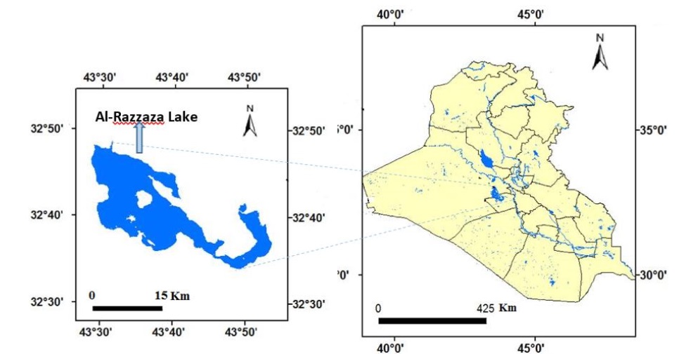
Al-Razzaza Lake, which was established in 1969 to protect the southern regions from heavy rains, is a part of the western plateau and is characterized by a semi-arid climate, hot in summer and cold in winter. The lake water level decreased in the past ten years due to the lack of rain and high temperatures, which affected the water quality and quantity, so it was studied and monitored the decline of the water level and calculate the surface area of the lake by several researchers using remote sensing techniques integrated with the GIS environment. Several researches were reviewed in this study, which dealt with the use of satellite images taken at different periods with the help of Geographic Information Systems (GIS) to detect change in the areas covered by Al-Razzaza Lake. Studies have shown that the area of the lake gradually decreased from 1990 to 2018 at a rate of about 1285 km2, then recovered slightly since 2018 at a rate of 118 km2. The results of the studies also showed that there is a real threat to the environment of Al-Razzaza Lake as a result of the significant deterioration that affects the water quality and the environment in the region. Consequently, researchers are required to expand the study of this problem to provide recommendations and propose appropriate solutions to reduce the resulting risks.
Downloads
References
A. K. Al-lami, R A. Abbood, A. A. Al Maliki, H. M. Hussain, A. J. Alabidi, Using of Different Satellite Derived Indices to Detect the Spatiotemporal Changes of the Al-Razzaza Lake, Iraq, Iraqi Journal of Science, Vol. 64, No. 2, pp: 1030-1040 2023, DOI: 10.24996/ijs.2023.64.2.44.
M. Hussain, D. Chen, A. Cheng, H. Wei, and D. Stanley, “Change detection from remotely sensed images: From pixel-based to object-based approaches,” ISPRS Journal of Photogrammetry and Remote Sensing, Vol. 80, pp. 91–106, Jun. 2013, Doi: 10.1016/j.isprsjprs.2013.03.006.
H. J. Jumaah, M. H. Ameen, G. H. Mohamed, Q. M. Ajaj, Monitoring and evaluation Al-Razzaza lake changes in Iraq using GIS and remote sensing technology, The Egyptian Journal of Remote Sensing and Space Sciences, Volume 25, Issue 1, Pp 313-321, 2022 Doi:10.1016/j.ejrs.2022.01.013.
Abdullah, Mukhalad, Nadhir Al-Ansari, and Jan Laue. "Water resources projects in Iraq: reservoirs in the natural depressions." Journal of Earth Sciences and Geotechnical Engineering 9, no. 4, 137-152, 2019.
Al-Qaraghuli, Shahad A., Azhar A. Hassan, Rafa A. Albaldawi, and Omnia K. Abd. "The Effect of Climate Changes on The Fluctuation of The Water Level of Al-Razzaza Lake, Iraq." Iraqi Journal of Science, 4464-4474, 2021, DOI: 10.24996/ijs. 2021.62.11 (SI).27.
M. Al-Dabbas, Q. Al-Kubaisi, T. Hussein, and S. Al-Qaraghuli, “Hydrochemical properties of groundwater of Rahaliya-Ekhedhur region, west Razzaza lake, Iraq,” MATEC Web of Conferences, vol. 162, p. 05002, 2018, Doi: 10.1051/matecconf/201816205002.
M. M. A. Al-Shamari “Geochemical Modeling of Groundwater in the Dammam Formation South of Razzaza Lake, Middle of Iraq,” The Iraqi Geological Journal, pp. 49–64, 2017, https://doi.org/10.46717/igj.50.1.4Ms-2017-06-26.
A. A. A. Al-Hisnawi, Y. K. Yasser, N. H. Kadhum, and J. M. Mustafa, “Hydrocarbon degradation test among the microbial community in oil-contaminated soil of power generators in Kerbala city, Iraq,” Iraqi Journal of Science, pp. 2900–2913, Jul. 2022, doi:10.24996/ijs.2022.63.7.14.
M. Al-Dabbas, Q. Al-Kubaisi, T. Hussein, and S. Al-Qaraghuli, “Hydrochemical Properties of Ground Water of Rahaliya-Ekhedhur Region, West Razzaza Lake, Iraq,” MATEC Web of Conferences, vol. 162, p. 05002, 2018, https://doi.org/10.1051/matecconf/201816205002.
H. Dibs, Comparison of derived Indices and unsupervised classification for AL-Razaza Lake dehydration extent using multi-temporal satellite data and remote sensing analysis, Journal of Engineering and Applied Sciences, VOL. 13, No. 24, 2018.
Kadhum, Sabah Noori, and Esraa Salam Alsudani. "Monitoring the Land Covers around Al-Razaza Lake-Iraq Based Upon Multi-Temporal Analysis Technique." Al-Mustansiriyah Journal of Science 32, no. 2, 2521-3520, 2021, https://doi.org/10.23851/mjs.v32i2.978.
M.A. Al-Obaidi, Y.K. AL-Timimi, Change detection in Mosul Dam Lake, north of Iraq using remote sensing and GIS techniques, Iraqi Journal of Agricultural Sciences Vol.53 No. (1), Pp.38-47 2022, https://doi.org/10.36103/ijas.v53i1.1506.
Abbas, Zahraa, and Hussein Sabah Jaber. "Accuracy assessment of supervised classification methods for extraction land use maps using remote sensing and GIS techniques." In IOP Conference Series: Materials Science and Engineering, vol. 745, no. 1, p. 012166. Iop Publishing, 2020, DOI 10.1088/1757-899X/745/1/012166.
Al-Abudi, Bushra Q., and Noor Zubair Kouder. "Change detection study for Al Razaza Lake and the surrounding area." In GIS & Geospatial Technologies Conference, Special Issue, pp. 180-191. 2016.
Acharya, Tri Dev, and In Tae Yang. "Landslide hazard zonation using GIS: a case study from Sindhupalchowk, Nepal." International Journal of Applied Engineering Research 10, no. 7, 18385-18394, 2015.
Abd El-Aziz, Ahmed Omar. "Monitoring and change detection along the Eastern Side of Qena Bend, Nile Valley, Egypt using GIS and remote sensing." Adv. Remote Sens 2, 276-281, 2013, http://dx.doi.org/10.4236/ars.2013.23030.
Hossen, Hickmat, and Abdelazim Negm. "Change detection in the water bodies of Burullus Lake, Northern Nile Delta, Egypt, using RS/GIS." Procedia Engineering 154, 951-958, 2016, https://doi.org/10.1016/j.proeng.2016.07.529.
A. Mohsen., Elshemy, M. & Zeidan, B.A. Change detection for Lake Burullus, Egypt using remote sensing and GIS approaches. Environ Sci Pollut Res 25, 30763–30771, 2018, doi.org/10.1007/s11356-016-8167-y.
Acharya, Tri Dev, Anoj Subedi, In Tae Yang, and Dong Ha Lee. "Combining water indices for water and background threshold in Landsat image." In Proceedings, vol. 2, no. 3, p. 143. MDPI, 2017, https://doi.org/10.3390/ecsa-4-04902.
Ali, Muhammad Ichsan, Gufran Darma Dirawan, Abdul Hafid Hasim, and Muh Rais Abidin. "Detection of changes in surface water bodies urban area with NDWI and MNDWI methods." International Journal on Advanced Science Engineering Information Technology 9, no. 3, 946-951, 2019, doi:10.18517/ijaseit.9.3.8692.
Downloads
Published
How to Cite
Issue
Section
License
Copyright (c) 2024 Afrah Medhat Rashed, Mufid Alhadithi, Fareed M. Alattar, Fayez Ahamd Massarwa

This work is licensed under a Creative Commons Attribution 4.0 International License.