
Methodology for Using Multi-Temporal Landsat Images to Monitor Urban Growth of Kirkuk Governorate
DOI:
https://doi.org/10.51173/jt.v6i2.1915Keywords:
Urban Growth, Landsat, GIS, Kirkuk, Change DetectionAbstract
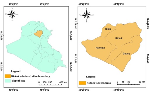
The growth of cities around the world creates difficulties for governments due to the strain it puts on resources and the negative impact on the environment and living conditions for residents. The Kirkuk Governorate has experienced significant urban growth in recent years, causing various environmental, economic, and social issues. the study aims to monitor the growth of Kirkuk Governorate from 1990-2020 using multi-spectral Landsat images to better understand urban development. Landsat-5 TM for 1990, Landsat-7 ETM+ for 2000, Landsat-5 TM for 2010, and Landsat-8 OLI for 2020 were used for this study. The Supervised Maximum Likelihood algorithm was utilized to categorize images into urban and non-urban areas, with accuracy rates ranging from 91.25% to 96.66% between 1990 and 2020. Post-classification change detection analysis was also conducted to observe changes in urban growth, revealing that the studied city expanded from 46.96 km2 to 193.25 km2 over 30 years. Over the past thirty years, the urban area of Kirkuk Governorate has increased while the non-urban area has decreased. This is due to factors such as population growth, political changes, and economic development. This study provides valuable information about this urban growth and can be used as a foundation for future studies on the region's socioeconomic and environmental changes.
Downloads
References
P. Shehu, L. S. Rikko, and M. B. Azi, “Monitoring urban growth and changes in land use and land cover: a strategy for sustainable urban development,” Int. J. Hum. Cap. Urban Manag., vol. 8, no. 1, pp. 111–126, 2023. DOI: 10.22034/IJHCUM.2023.01.09.
United Nations, “Revision of World Urbanization Prospects.,” 2018. https://www.un.org/development/desa/en/news/population/2018-revision-of-world-urbanization-prospects.html.
R. B. Bhagat and S. Mohanty, “Emerging pattern of urbanization and the contribution of migration in urban growth in India,” Asian Popul. Stud., vol. 5, no. 1, pp. 5–20, 2009. https://doi.org/10.1080/17441730902790024.
B. Bhatta, Analysis of urban growth and sprawl from remote sensing data. Springer Science & Business Media, 2010. DOI: 10.1007/978-3-642-05299-6.
L. Altieri, D. Cocchi, G. Pezzi, E. M. Scott, and M. Ventrucci, “Urban sprawl scatterplots for Urban Morphological Zones data,” Ecol. Indic., vol. 36, pp. 315–323, 2014. https://doi.org/10.1016/j.ecolind.2013.07.011.
S. Das and D. P. Angadi, “Land use land cover change detection and monitoring of urban growth using remote sensing and GIS techniques: A micro-level study,” GeoJournal, vol. 87, no. 3, pp. 2101–2123, 2022. https://doi.org/10.1007/s40808-018-0547-5.
T. A. Akbar, Q. K. Hassan, S. Ishaq, M. Batool, H. J. Butt, and H. Jabbar, “Investigative spatial distribution and modelling of existing and future urban land changes and its impact on urbanization and economy,” Remote Sens., vol. 11, no. 2, p. 105, 2019. https://doi.org/10.3390/rs11020105.
M. Acheampong, Q. Yu, L. D. Enomah, J. Anchang, and M. Eduful, “Land use/cover change in Ghana’s oil city: Assessing the impact of neoliberal economic policies and implications for sustainable development goal number one–A remote sensing and GIS approach,” Land use policy, vol. 73, pp. 373–384, 2018. https://doi.org/10.1016/j.landusepol.2018.02.019.
H. H. Nguyen, F. Recknagel, and W. Meyer, “Effects of projected urbanization and climate change on flow and nutrient loads of a Mediterranean catchment in South Australia,” Ecohydrol. Hydrobiol., vol. 19, no. 2, pp. 279–288, 2019. https://doi.org/10.1016/j.ecohyd.2018.10.001.
S. M. Oswald et al., “Using urban climate modelling and improved land use classifications to support climate change adaptation in urban environments: A case study for the city of Klagenfurt, Austria,” Urban Clim., vol. 31, p. 100582, 2020. https://doi.org/10.1016/j.uclim.2020.100582.
S. Mansour, M. Al-Belushi, and T. Al-Awadhi, “Monitoring land use and land cover changes in the mountainous cities of Oman using GIS and CA-Markov modelling techniques,” Land use policy, vol. 91, p. 104414, 2020. https://doi.org/10.1016/j.landusepol.2019.104414.
S. Chaturvedi, K. Shukla, E. Rajasekar, and N. Bhatt, “A spatio-temporal assessment and prediction of Ahmedabad’s urban growth between 1990–2030,” J. Geogr. Sci., vol. 32, no. 9, pp. 1791–1812, 2022. https://doi.org/10.1016/j.ejrs.2019.05.001
D. Maktav and F. S. Erbek, “Analysis of urban growth using multi‐temporal satellite data in Istanbul, Turkey,” Int. J. Remote Sens., vol. 26, no. 4, pp. 797–810, 2005. https://doi.org/10.1080/01431160512331316784.
B. R. Pickard, D. Van Berkel, A. Petrasova, and R. K. Meentemeyer, “Forecasts of urbanization scenarios reveal trade-offs between landscape change and ecosystem services,” Landsc. Ecol., vol. 32, pp. 617–634, 2017. DOI 10.1007/s10980-016-0465-8.
S. Patra, S. Sahoo, P. Mishra, and S. C. Mahapatra, “Impacts of urbanization on land use/cover changes and its probable implications on local climate and groundwater level,” J. urban Manag., vol. 7, no. 2, pp. 70–84, 2018. https://doi.org/10.1016/j.jum.2018.04.006.
J. Kim and J. H. Ryu, “Modeling hydrological and environmental consequences of climate change and urbanization in the Boise River Watershed, Idaho,” JAWRA J. Am. Water Resour. Assoc., vol. 55, no. 1, pp. 133–153, 2019. https://doi.org/10.3390/w12092436.
I. Dutta and A. Das, “Application of geo-spatial indices for detection of growth dynamics and forms of expansion in English Bazar Urban Agglomeration, West Bengal,” J. Urban Manag., vol. 8, no. 2, pp. 288–302, 2019. https://doi.org/10.1016/j.jum.2019.03.007.
M. M. Katyambo and M. M. Ngigi, “Spatial monitoring of urban growth using GIS and remote sensing: a case study of Nairobi metropolitan area, Kenya,” 2017, DOI: 10.5923/j.ajgis.20170602.03.
S. Rahaman, P. Kumar, R. Chen, M. E. Meadows, and R. B. Singh, “Remote sensing assessment of the impact of land use and land cover change on the environment of Barddhaman district, West Bengal, India,” Front. Environ. Sci., vol. 8, p. 127, 2020. https://doi.org/10.3389/fenvs.2020.00127.
N. H. Hamed, M. M. Bayati, and H. R. Mohammed, “Digital Change Detection and Map Analysis for Urban Expansion and Land Cover Changes in Karbala City,” Eng. Technol. J., vol. 38, no. 9, pp. 1246–1256, 2020. https://doi.org/10.30684/etj.v38i9A.296.
N. Q. Omar, S. A. M. Sanusi, W. M. W. Hussin, N. Samat, and K. S. Mohammed, “Markov-CA model using analytical hierarchy process and multiregression technique,” in IOP conference series: earth and environmental science, 2014, vol. 20, no. 1, p. 12008. DOI 10.1088/1755-1315/20/1/012008.
J. A. Vinoth Kumar, S. K. Pathan, and R. J. Bhanderi, “Spatio-temporal analysis for monitoring urban growth–a case study of Indore city,” J. Indian Soc. Remote Sens., vol. 35, pp. 11–20, 2007. doi:10.1007/bf02991829.
T. Mugiraneza, S. Hafner, J. Haas, and Y. Ban, “Monitoring urbanization and environmental impact in Kigali, Rwanda using Sentinel-2 MSI data and ecosystem service bundles,” Int. J. Appl. Earth Obs. Geoinf., vol. 109, p. 102775, 2022. https://doi.org/10.1016/j.jag.2022.102775.
U. Choudhury and R. Kanga, “Gis And Stochastic Based Assessment And Modelling Of Urban Growth Patterns - A Review,”, Suresh Gyan Vihar University journal of climate change and water, vol. 9, pp. 27–45, 2022.
T. Lillesand, R. W. Kiefer, and J. Chipman, Remote sensing and image interpretation. John Wiley & Sons, 2015.
R. Sharma, A. Ghosh, and P. K. Joshi, “Analysing spatio-temporal footprints of urbanization on environment of Surat city using satellite-derived bio-physical parameters,” Geocarto Int., vol. 28, no. 5, pp. 420–438, 2013. https://doi.org/10.1080/10106049.2012.715208.
D. Dutta, A. Rahman, and A. Kundu, “Growth of Dehradun city: An application of linear spectral unmixing (LSU) technique using multi-temporal landsat satellite data sets,” Remote Sens. Appl. Soc. Environ., vol. 1, pp. 98–111, 2015. https://doi.org/10.1016/j.rsase.2015.07.001.
L. H. Nguyen, S. V Nghiem, and G. M. Henebry, “Expansion of major urban areas in the US Great Plains from 2000 to 2009 using satellite scatterometer data,” Remote Sens. Environ., vol. 204, pp. 524–533, 2018. https://doi.org/10.1016/j.rse.2017.10.004.
C. R. Suribabu, J. Bhaskar, and T. R. Neelakantan, “Land use/cover change detection of Tiruchirapalli City, India, using integrated remote sensing and GIS tools,” J. Indian Soc. Remote Sens., vol. 40, pp. 699–708, 2012. DOI 10.1007/s12524-011-0196-x.
S. Singh and K. Sarma, “Analyzing the change in land cover dynamics: A case study of Delhi,” 2023. https://doi.org/10.21203/rs.3.rs-2743780/v1.
V. N. Mishra and P. K. Rai, “A remote sensing aided multi-layer perceptron-Markov chain analysis for land use and land cover change prediction in Patna district (Bihar), India,” Arab. J. Geosci., vol. 9, pp. 1–18, 2016. DOI 10.1007/s12517-015-2138-3.
F. Ahmad, L. Goparaju, and A. Qayum, “LULC analysis of urban spaces using Markov chain predictive model at Ranchi in India,” Spat. Inf. Res., vol. 25, no. 3, pp. 351–359, 2017. DOI 10.1007/s41324-017-0102-x.
B. Rimal, L. Zhang, H. Keshtkar, B. N. Haack, S. Rijal, and P. Zhang, “Land use/land cover dynamics and modeling of urban land expansion by the integration of cellular automata and markov chain,” ISPRS Int. J. Geo-Information, vol. 7, no. 4, p. 154, 2018. https://doi.org/10.3390/ijgi7040154
F. Hossain and M. Moniruzzaman, “Environmental change detection through remote sensing technique: A study of Rohingya refugee camp area (Ukhia and Teknaf sub-district), Cox’s Bazar, Bangladesh,” Environ. Challenges, vol. 2, p. 100024, 2021. https://doi.org/10.1016/j.envc.2021.100024.
M. O. Adepoju, A. C. Millington, and K. T. Tansey, “Land use/land cover change detection in metropolitan Lagos (Nigeria): 1984–2002,” in ASPRS 2006 Annual Conference Reno, Nevada May, 2006, pp. 1–5.
M. K. Leta, T. A. Demissie, and J. Tränckner, “Hydrological responses of watershed to historical and future land use land cover change dynamics of Nashe watershed, Ethiopia,” Water, vol. 13, no. 17, p. 2372, 2021. https://doi.org/10.3390/w13172372.
W. Pervaiz, V. Uddin, S. A. Khan, and J. A. Khan, “Satellite-based land use mapping: comparative analysis of Landsat-8, Advanced Land Imager, and big data Hyperion imagery,” J. Appl. Remote Sens., vol. 10, no. 2, p. 26004, 2016. https://doi.org/10.1117/1.JRS.10.026004.
A. Koranteng, I. Adu-Poku, E. Donkor, and T. Zawiła-Niedźwiecki, “Geospatial assessment of land use and land cover dynamics in the mid-zone of Ghana,” Folia For. Pol. Ser. A. For., vol. 62, no. 4, pp. 288–305, 2020. http://dx.doi.org/10.2478/ffp-2020-0028
M. M. Aburas, S. H. O. Abdullah, M. F. Ramli, and Z. H. Asha’ari, “Land suitability analysis of urban growth in Seremban Malaysia, using GIS based analytical hierarchy process,” Procedia Eng., vol. 198, pp. 1128–1136, 2017. https://doi.org/10.1016/j.proeng.2017.07.155.
S. I. Wadeea, R. M. Hamdoon, and M. S. Al-Zuhairy, “Effects of Industrial Wastewater on Water Quality Tigris River at Baghdad Using (GIS) Technique,” J. Tech., vol. 4, no. 4, pp. 1–11, 2022, [Online]. Available: https://journal.mtu.edu.iq/index.php/MTU/article/view/569. doi.org/10.51173/jt.v4i4.569.
S. Panwar and D. S. Malik, “Evaluating land use/land cover change dynamics in Bhimtal lake catchment area, using remote sensing & GIS techniques,” J. Remote Sens. GIS, vol. 6, no. 199, p. 2, 2017. DOI: 10.4172/2469-4134.1000199.
D. Aldogom, N. Aburaed, M. Al-Saad, S. Al Mansoori, M. R. Al Shamsi, and A. A. Al Maazmi, “Multi temporal satellite images for growth detection and urban sprawl analysis; Dubai City, UAE,” in Remote Sensing Technologies and Applications in Urban Environments IV, 2019, vol. 11157, pp. 71–81. https://doi.org/10.1117/12.2533097.
A. F. Koko, W. Yue, G. A. Abubakar, A. A. N. Alabsi, and R. Hamed, “Spatiotemporal influence of land use/land cover change dynamics on surface urban heat island: A case study of Abuja metropolis, Nigeria,” ISPRS Int. J. Geo-Information, vol. 10, no. 5, p. 272, 2021. https://doi.org/10.3390/ijgi10050272.
V. Chettry, “Revision of world urbanization prospects,” Environ. Monit. Assess., vol. 194, no. 12, p. 860, 2022.
R. W. Aslam, H. Shu, and A. Yaseen, “Monitoring the population change and urban growth of four major Pakistan cities through spatial analysis of open source data,” Ann. GIS, pp. 1–13, 2023. https://doi.org/10.1080/19475683.2023.2166989.
I. R. Hegazy and M. R. Kaloop, “Monitoring urban growth and land use change detection with GIS and remote sensing techniques in Daqahlia governorate Egypt,” Int. J. Sustain. Built Environ., vol. 4, no. 1, pp. 117–124, 2015. https://doi.org/10.1016/j.ijsbe.2015.02.005.
S. N. MohanRajan, A. Loganathan, and P. Manoharan, “Survey on Land Use/Land Cover (LU/LC) change analysis in remote sensing and GIS environment: Techniques and Challenges,” Environ. Sci. Pollut. Res., vol. 27, pp. 29900–29926, 2020. https://doi.org/10.1007/s11356-020-09091-7.
H. B. Wakode, K. Baier, R. Jha, and R. Azzam, “Analysis of urban growth using Landsat TM/ETM data and GIS—a case study of Hyderabad, India,” Arab. J. Geosci., vol. 7, pp. 109–121, 2014. DOI 10.1007/s12517-013-0843-3.
M. Usman, R. Liedl, M. A. Shahid, and A. Abbas, “Land use/land cover classification and its change detection using multi-temporal MODIS NDVI data,” J. Geogr. Sci., vol. 25, pp. 1479–1506, 2015. N. T. I. Ismael, “Urban expansion indicators of cities "Case study for Arab cities,” J. Tech., vol. 2, no. 1, pp. 1–21, 2020, doi: 10.51173/jt.v2i1.51.
T. W. Meshesha, S. K. Tripathi, and D. Khare, “Analyses of land use and land cover change dynamics using GIS and remote sensing during 1984 and 2015 in the Beressa Watershed Northern Central Highland of Ethiopia,” Model. Earth Syst. Environ., vol. 2, pp. 1–12, 2016. DOI 10.1007/s40808-016-0233-4.
S. Kaliraj, N. Chandrasekar, K. K. Ramachandran, Y. Srinivas, and S. Saravanan, “Coastal landuse and land cover change and transformations of Kanyakumari coast, India using remote sensing and GIS,” Egypt. J. Remote Sens. Sp. Sci., vol. 20, no. 2, pp. 169–185, 2017. https://doi.org/10.1016/j.ejrs.2017.04.003.
S. Bagaeen and H. Hijazi, “The role of land use change in developing city spatial models in Jordan: The case of the Irbid master plan (1970–2017),” Alexandria Eng. J., vol. 58, no. 3, pp. 861–875, 2019. https://doi.org/10.1016/j.aej.2019.08.001.
S. Chaturvedi, K. Shukla, E. Rajasekar, and N. Bhatt, “A spatio-temporal assessment and prediction of Ahmedabad’s urban growth between 1990–2030,” J. Geogr. Sci., vol. 32, no. 9, pp. 1791–1812, 2022, https://doi.org/10.1007/s11442-022-2023-4.
N. T. I. Ismael, “Urban expansion indicators of cities "Case study for Arab cities,” J. Tech., vol. 2, no. 1, pp. 1–21, 2020, doi: 10.51173/jt.v2i1.51.
E. Belief, “GIS based spatial modeling to mapping and estimation relative risk of different diseases using inverse distance weighting (IDW) interpolation algorithm and evidential belief function (EBF)(Case study: Minor Part of Kirkuk City, Iraq),” Int J Eng Technol, vol. 7, no. 4.37, pp. 185–191, 2018, https://doi.org/10.14419/ijet.v7i4.37.24098.
A. M. Noori, W. M. Qader, F. G. Saed, and Z. A. Hamdany, “Quantification of morphometric parameters to analyze the watershed characteristics: A case study of Rosti Watershed, Iraq,” Int. J. Adv. Sci. Technol., vol. 28, no. 13, pp. 273–289, 2019.
Central statistics Organisation, “Yearly Statistics Report (2020 Part Two).Ministry of Planning in Iraq,” p. 42, 2020.
W. B. F. John I. Clarke, W. B. Fisher, Population Geography (2nd ed.). Elsevier Science. Retrieved from. 2013. [Online]. Available: https://www.perlego.com/book/1897927/population-geography-pergamon-oxford-geographies-pdf (Original work published 2013).
A. Asokan and J. Anitha, “Change detection techniques for remote sensing applications: A survey,” Earth Sci. Informatics, vol. 12, pp. 143–160, 2019. doi:10.1007/s12145-019-00380-5. https://doi.org/10.1007/s12145-019-00380-5.
M. K. Jat, P. K. Garg, and D. Khare, “Monitoring and modelling of urban sprawl using remote sensing and GIS techniques,” Int. J. Appl. earth Obs. Geoinf., vol. 10, no. 1, pp. 26–43, 2008. https://doi.org/10.1016/j.jag.2007.04.002.
M. T. Rahman, “Detection of land use/land cover changes and urban sprawl in Al-Khobar, Saudi Arabia: An analysis of multi-temporal remote sensing data,” ISPRS Int. J. Geo-Information, vol. 5, no. 2, p. 15, 2016. https://doi.org/10.3390/ijgi5020015.
K. Alkaradaghi, S. S. Ali, N. Al-Ansari, and J. Laue, “Land use classification and change detection using multi-temporal Landsat imagery in Sulaimaniyah Governorate, Iraq,” in Advances in Remote Sensing and Geo Informatics Applications: Proceedings of the 1st Springer Conference of the Arabian Journal of Geosciences (CAJG-1), Tunisia 2018, 2019, pp. 117–120. https://doi.org/10.1007/978-3-030-01440-7_28.
W. M. M. Al-Hameedi, J. Chen, C. Faichia, B. Nath, B. Al-Shaibah, and A. Al-Aizari, “Geospatial Analysis of Land Use/Cover Change and Land Surface Temperature for Landscape Risk Pattern Change Evaluation of Baghdad City, Iraq, Using CA–Markov and ANN Models,” Sustainability, vol. 14, no. 14, p. 8568, 2022. https://doi.org/10.3390/su14148568.
J. R. Anderson, A land use and land cover classification system for use with remote sensor data, vol. 964. US Government Printing Office, 1976.
G. M. Foody, “Status of land cover classification accuracy assessment,” Remote Sens. Environ., vol. 80, no. 1, pp. 185–201, 2002. https://doi.org/10.1016/S0034-4257(01)00295-4.
M. L. McHugh, “Interrater reliability: the kappa statistic,” Biochem. medica, vol. 22, no. 3, pp. 276–282, 2012.
R. G. Congalton, R. G. Oderwald, and R. A. Mead, “Assessing Landsat classification accuracy using discrete multivariate analysis statistical techniques,” Photogramm. Eng. Remote Sensing, vol. 49, no. 12, pp. 1671–1678, 1983.
M. Mathewos, S. M. Lencha, and M. Tsegaye, “Land use and land cover change assessment and future predictions in the Matenchose Watershed, Rift Valley Basin, using CA-Markov simulation,” Land, vol. 11, no. 10, p. 1632, 2022. https://doi.org/10.3390/land11101632.
Downloads
Published
How to Cite
Issue
Section
License
Copyright (c) 2024 Tabark Y. Gehad, Nejat Q. Omer, Nada S. Abdulmajeed

This work is licensed under a Creative Commons Attribution 4.0 International License.